
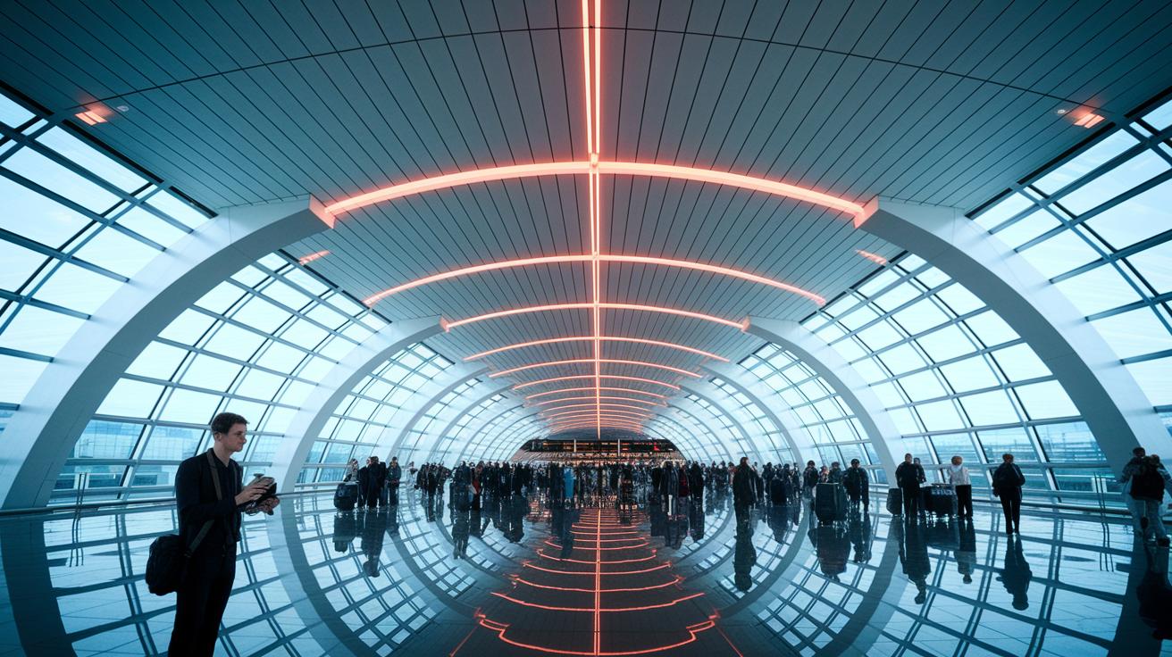
Ever felt disoriented in a crowded airport? New indoor wayfinding tech can help you out. It uses Bluetooth beacons and Wi‑Fi signals to guide you from check‑in to your boarding gate. This system works much better than GPS inside buildings because it gives real‑time updates and finds quicker routes even when terminals are busy. In this post, we break down how indoor wayfinding works at airports and explain why it makes your travel experience smoother and less stressful.
How indoor wayfinding technology at airports works
Indoor positioning systems use modern tech to help travelers navigate inside airports. Instead of relying on GPS, which doesn’t work well indoors, these systems use Bluetooth beacons or Wi‑Fi signals to find your exact location. They provide clear, step‑by‑step directions from check‑in to security, immigration, and the boarding gate.
Airports install these beacons in busy public areas and corridors to ease crowd flow and reduce confusion. For instance, you might see a real‑time message like “Your gate has moved to Terminal B, Floor 2,” so you always have the latest updates. The system even estimates walking times and suggests alternative routes during peak hours.
Indoor location services also collect data on how passengers move around. This information helps airport managers make better use of space during terminal expansions or sudden rushes. By working with other new aviation technologies, these systems not only guide you safely but also improve the overall efficiency of the airport.
Interactive maps and live updates provide clear instructions on where to go next, cutting down congestion and making your airport journey smoother.
Core components of indoor wayfinding technology at airports

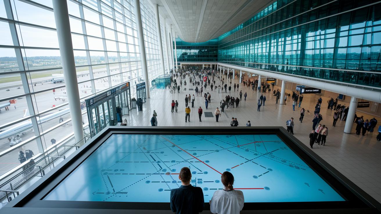
Smart AI turns basic CAD floor plans into interactive terminal maps in minutes. This tech changes static blueprints into clear, dynamic maps that update as terminal layouts change. Picture a digital sign showing simple steps like "Go 50 feet to security" so you always know where to head.
Indoor positioning uses beacon tech and Wi‑Fi triangulation (using network signals to find your spot) to pinpoint where you are. Even in busy terminals, this system gives accurate details. Imagine your mobile app showing your exact location and guiding you to your gate, the kind of help you can really count on.
Airport mobile apps add extra convenience by offering walk time estimates, favorite spots, and AR (augmented reality) cues that overlay directions on your camera view. A tap might reveal an AR arrow leading you through a bustling corridor straight to baggage claim. This makes your journey smoother and cuts down on delays.
Digital signs and interactive kiosks are set up in key spots like check‑in areas and near security. They let you search for destinations and give updated turn-by-turn directions when things change. These displays link with flight info, parking, retail, and security systems to provide real-time updates across the airport.
All these elements work together to form a complete wayfinding ecosystem that offers real-time guidance and boosts terminal efficiency. By merging mapping, positioning, and digital displays, the system quickly adapts to changes so you're informed every step of the way.
Operational mechanisms of indoor wayfinding technology at airports
Indoor wayfinding starts with AI that reads building blueprints and turns them into detailed maps covering several floors. The system converts static computer-aided design (CAD) plans into interactive layouts that work for complex airport terminals. It uses signals from beacons and Wi‑Fi triangulation (using Wi‑Fi signals to figure out your location) because GPS doesn't work indoors. This approach helps track where you are very accurately.
After creating the maps, route-planning algorithms pick the best routes for you. They suggest paths based on travel time and accessibility (following ADA guidelines for those with disabilities). The system looks at elevators, ramps, and stairways to offer options that work for everybody. Plus, it keeps learning and improving from how passengers move through the terminal.
When things change inside the terminal, the maps update in real time. If a gate gets reassigned or construction changes a corridor, the maps refresh right away. The platform even offers over 40 languages, making it easier for travelers worldwide and reducing the need for extra help from staff. Whether you check the map on a mobile app, a kiosk, or digital signs, every step of your airport journey stays clear and well-managed.
Benefits of indoor wayfinding technology at airports explained
Indoor wayfinding tech helps passengers move around easily and gives airports clear benefits. It shows simple, step-by-step directions that cut long lines and reduce confusion as travelers move from check‑in to security, boarding gates, and other spots. This clear guidance keeps crowds away from busy areas, so everything runs smoothly.
Airport staff also get a boost from accurate digital maps. Interactive screens show service corridors and set routes, making it faster to find equipment. The system even tracks items like wheelchairs, baggage carts, and maintenance tools. When these items stay in place, employees spend less time searching and more time getting things done.
In emergencies, having exact indoor location data is essential. The system speeds up evacuations and can block off routes for a safe exit. Real-time updates work with aviation security (rules that keep travelers safe) to give first responders the right information when every second counts.
By studying movement patterns, airports can use space better and adjust staffing where passengers are busiest. This data also helps management place retail offers and concessions along common routes, boosting extra revenue.
Its scalable design means the system can grow with the airport without expensive changes. As terminals expand, efficient navigation stays in place. All of these benefits show why indoor wayfinding tech is a key tool for modern airports.
Real-world examples of indoor wayfinding technology at airports explained: Awesome
Airports are using new tech to help passengers move easily while keeping safety a top priority. Modern mobile apps now show simple arrow directions on your phone. Imagine standing in a terminal, phone in hand, and seeing an arrow right on the floor that points you to your gate. One major airport even uses smart maps that update within 24 hours when construction or changes occur, so you're always on track.
In emergency drills, digital signs and kiosks quickly reroute people along safe paths. This smart system not only shows the best exit routes but also eases pressure on staff during critical times. Retail stores have seen a 15% lift in visitors by adding promotional cues along these navigation paths. These examples show how interactive digital maps and indoor navigation systems are transforming the airport experience.
Future trends in indoor wayfinding technology at airports
Airports are gearing up to help travelers move easier through busy terminals. New tech uses a mix of beacons, LiDAR (a system that uses light to measure distances), and inertial measurement units (tiny sensors that track motion) to pinpoint your location with great accuracy, even in tricky spots where older methods struggle.
Another breakthrough is cloud‑based navigation. This smart system updates maps in real time, so any change, whether it’s a gate swap, a new store, or a service shift, shows up instantly on your mobile app, digital sign, or kiosk. That means passengers and airport staff can adapt quickly to new layouts.
There’s also progress in machine learning. Algorithms will soon study how travelers move and suggest better routes as you go. Plus, airports are testing voice‑activated wayfinding assistants and even robots to help with luggage. These advances promise an easier, hands‑free experience.
Together, these innovations are set to cut travel stress and ease congestion, delivering a seamless journey from check‑in to boarding.
Final Words
In the action, this article walked through how indoor maps, beacon signals, and digital displays work in tandem to guide travelers through airport terminals. It explained key components and operational mechanisms that simplify passenger movement. The blog also shed light on benefits like reduced congestion and enhanced safety. Indoor wayfinding technology at airports explained helps improve both the traveler and staff experience. With ongoing innovations on the horizon, airports continue advancing to keep your travel experience smooth and stress-free.
FAQ
Q: What is indoor wayfinding technology at airports and how does it work?
A: Indoor wayfinding technology at airports uses indoor positioning systems like Bluetooth beacons and Wi‑Fi triangulation to replace paper maps, guide travelers through terminals, and manage passenger flow efficiently.
Q: What core components make up airport indoor wayfinding systems?
A: Indoor wayfinding relies on AI mapping, Bluetooth beacons, digital signage, mobile apps with AR overlays, and integration with flight and retail systems to provide continuous, real‑time route guidance.
Q: How are indoor wayfinding operations managed within airports?
A: Indoor wayfinding operations depend on AI‑generated multi-level maps, beacon signals, Wi‑Fi triangulation, and route‑planning algorithms that offer real‑time updates and accessible pathways for a smoother passenger experience.
Q: What benefits do indoor wayfinding systems offer airports and travelers?
A: Indoor wayfinding systems reduce congestion, speed up navigation, optimize terminal operations, assist in emergencies through precise location data, and even boost retail foot traffic by directing passengers along key paths.
Q: What are some real-world examples of indoor wayfinding implementations at airports?
A: Some airports use AR directional overlays on mobile apps, deploy AI‑driven maps for rapid updates during construction, and employ dynamic digital signage to reroute passengers, which also helps increase retail engagement.
Q: What future trends are expected in airport indoor wayfinding technology?
A: Future trends point to sensor fusion for ultra‑accurate tracking, cloud‑based navigation systems for global updates, and machine learning that refines route suggestions, along with autonomous tools to guide travelers.