
Ever wonder how pilots know what's going on high above? They rely on aviation radar, which acts like a live map of the sky. Radar sends out radio bursts and listens for the echoes bouncing back from aircraft. Air traffic controllers use this signal to track every plane in real time, keeping flights safe. In this look at radar, we'll explain how it works, cover different ways it detects planes, and show how it sparks innovation in aircraft design. This technology is changing air travel, making it more predictable and secure.
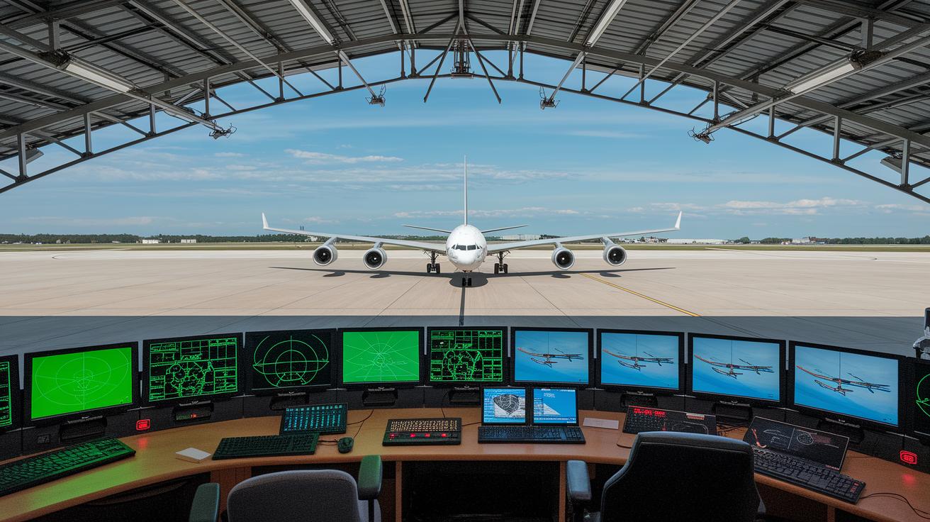
Aviation Radar Fundamentals
Aviation radar works by sending out short radio pulses and then listening for the echoes that bounce back from aircraft. Did you know a single pulse can travel thousands of miles in just milliseconds? This quick bounce gives controllers a fast snapshot of what’s up in the sky.
The system has four main parts. First, the transmitter sends radio waves into the sky. Next, the antenna directs these waves into specific areas of airspace. When the waves hit an aircraft, the receiver picks up the returning signals. Finally, the signal processor checks the echoes to figure out how far away the aircraft is, its direction, and its speed.
Modern flight tracking relies on this real-time echo analysis. Controllers can see details such as an aircraft's speed and position compared to others. They can even filter the signals, say, to show only planes flying above 30,000 feet, to cut out extra noise.
Together, these elements give a clear picture of the sky, helping ensure safe air travel every day.
Aviation Radar Detection System Types
Radar systems play a key role in tracking aircraft across the sky. Primary radar sends out short radio bursts that bounce off any object, while secondary surveillance radar listens for replies from the plane’s transponder. In addition, ADS-B detection gathers signals that planes broadcast directly, giving air traffic controllers even more precise information.
Airborne devices like FlightStick 1090, FlightStick 978, and FlightStick VHF Airband are crucial for ADS-B reception. These transponders capture and send data so controllers can quickly see where an aircraft is, how high it is flying, and how fast it’s moving. Ground-based and portable units also help by detecting flights that might not appear on standard systems, ensuring that even unexpected targets are spotted.
Operators can fine-tune what appears on their screens by using filters. Settings let them narrow the view by altitude, source, or alert flags, turning huge streams of radar information into clear and useful data.
• Primary radar: Sends out radio pulses that bounce off anything in the sky.
• Secondary surveillance radar: Relies on responses from aircraft transponders.
• ADS-B detection: Uses direct broadcasts from airplanes to add extra tracking detail.
Aviation Radar Technological Advancements
Modern radar upgrades are pushing aircraft innovation in exciting new ways. New tools like ADS-B hardware (which shows an aircraft's precise location) and satellite-based ADS-B work with weather overlays to help pilots adjust routes when conditions worsen. These systems not only track planes accurately but also deliver crucial weather details.
Digital imaging sensors and multispectral scanning now offer sharper images that catch even small or distant objects. This means air traffic controllers can see clearer details, even in heavy weather or busy airspace. Plus, advanced Doppler techniques improve tracking at low altitudes, ensuring no moving target slips by unnoticed.
Clutter reduction algorithms help filter out static objects and natural echoes, giving controllers a cleaner, high-resolution view of the skies. Better signal processing and sharper data lead to more precise information. Manufacturers are keeping up with this progress, meeting key standards like the FAA 2020 ADS-B Mandate and ICAO’s GADSS framework, all while boosting safety.
Ongoing research in signal processing is set to bring even more improvements. With regular updates, radar systems will soon deliver higher accuracy, faster data, and smarter surveillance. This continuous innovation is shaping the future of aircraft monitoring and operational safety.
Aviation Radar Weather Integration Techniques
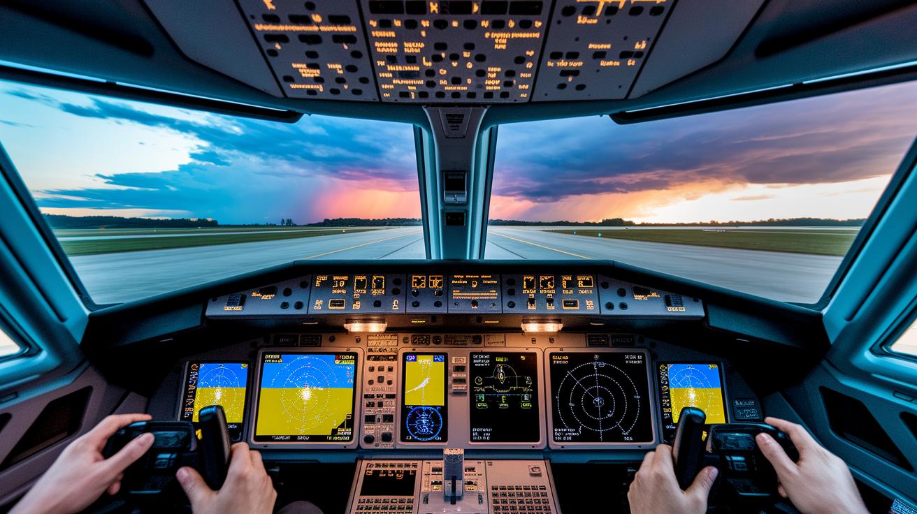
Today's advanced radar systems combine weather detection with aircraft tracking, making flights safer and smoother. For example, Doppler weather radar (tech that detects storm cells, wind shear, and turbulence) gives pilots a live view of weather patterns as they develop, so they can adjust their flight paths in time.
Inside the cockpit, radar echoes mix with satellite feeds and ground sensor data to create clear and detailed weather maps. Imagine a screen showing an overlay of an approaching storm, built from live radar signals and up-to-date satellite images. Amazingly, in just seconds, pilots receive a complete weather update that blends these data sources, offering almost real-time forecasts. This smart fusion of information helps track even rapidly changing conditions.
Forecasting tools take this further by merging radar data with satellite imagery to predict weather trends along planned routes. Crews get alerts for hazards like hail, heavy rain, or lightning. Picture a pilot seeing a clear alert that says, "Lightning detected 2 miles ahead; adjust altitude now." Such early warnings lead to quicker, safer decisions.
Airlines benefit from these integrated systems by planning smoother, more efficient routes. Detailed weather maps highlight potential hazards well before they become critical. With these tools in hand, pilots and controllers work together to keep flights on course, no matter how challenging the weather gets.
Aviation Radar Data Visualization and Interfaces
Air traffic control screens and live feed monitors now change the way controllers and fans see radar information. Platforms like Flight Data, Fleet Tracker, and Airport View show live ADS-B (automatic tracking signals from aircraft) and radar tracks in real time. These systems add clear map layers that show GPS details, global ranks, and callsign info so viewers can quickly get the full picture.
Users can easily tweak the display to suit their needs. They can change icon and text sizes for better visibility. Using UTC date filters lets them look back at past events by pinpointing the exact time something happened. A ground-vehicle toggle helps separate aerial data from on-ground movements so each track is seen as it should be. There’s even a view that ranks targets based on how many users click on them, helping you focus on the most reliable signals.
Photo uploads let community members add images that enrich the data. Data sharing features make it easier for air traffic teams to collaborate. Plus, special options help newcomers learn the system through guided introductions.
Tracking analytics dig deeper by studying flight paths and trends. Mapping tools spot increases or changes in traffic patterns, helping operators quickly adjust to new situations. With live feed updates, users get the latest information during busy periods. Together, these tools provide a clear picture of airspace operations, helping everyone stay informed and making air travel safer and more efficient.
Aviation Radar Regulatory Compliance and Standards

Radar installations must meet the highest performance standards and follow strict rules. Operators set up these systems according to mandates like the FAA's 2020 ADS-B rule and ICAO's GADSS (a set of guidelines for safety in aviation). These scheduled installations help boost safety.
Technicians check everything. They measure transmitter power, manage frequencies, and test if the system works well with others. Their tests also ensure that equipment communicates properly with tools like TCAS (a system that helps avoid collisions).
Testing rules make sure equipment stays within safe margins, giving pilots and controllers timely alerts. Regular inspections and firmware updates keep systems reliable. Certification mixes modern technology with safety checks, following global guidelines. Operators must also connect radar and ADS-B feeds with collision avoidance systems for extra safety.
These detailed checks not only meet tough safety standards but also support innovation in aircraft technology. In short, strict compliance fulfills legal rules and builds trust among pilots and passengers by reinforcing safety every day.
Aviation Radar Historical Evolution
During World War II, pulse radar was born. This new technology let operators bounce radio waves off enemy planes to detect them. It set the stage for the radar systems we use today.
In the 1950s, radar took a big step forward with secondary surveillance radar (SSR). This system uses transponders on aircraft (devices that send extra flight details) to give air traffic controllers a clearer picture of where planes are, much like a focused searchlight revealing hidden objects.
The 1990s brought another breakthrough with ADS-B, which stands for Automatic Dependent Surveillance-Broadcast. In simple terms, aircraft now broadcast their own position, letting nearby pilots and controllers know exactly where they are. It was a straightforward idea that made sky tracking far more effective.
Collaboration also played a key role. Partnerships like those between AirNav Radar and the Neurored Alliance, along with ventures such as the Kitty Hawk Challenge, pushed engineers to look into networked sensors and satellites. Today, linking sensors both on the ground and in space is the goal, a system that creates a continuous grid of radar coverage.
• WWII pulse radar innovations
• 1950s SSR advancements
• 1990s ADS-B breakthrough
• Modern sensor networks for global tracking
Each milestone built a bridge to a more connected and informed way to navigate our skies, helping to keep air travel safe and efficient.
Aviation Radar Maintenance and Calibration Best Practices
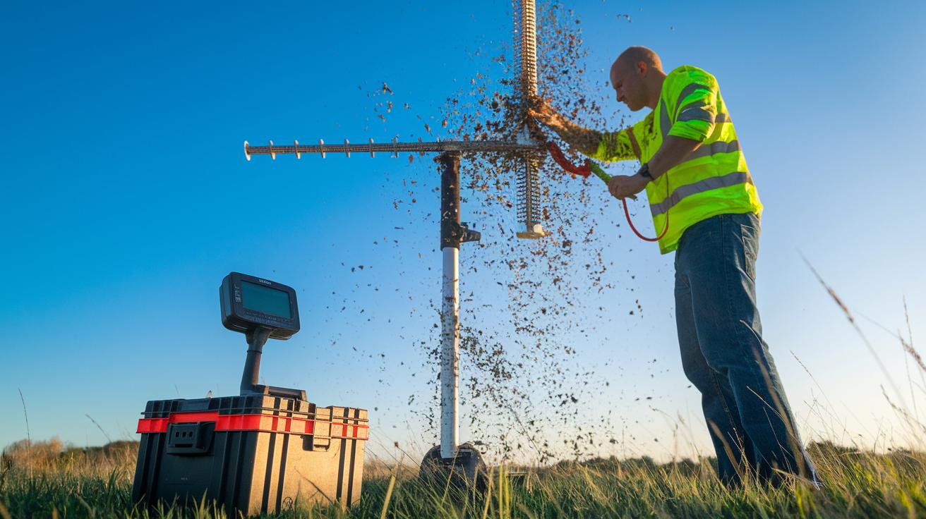
Regular checks keep aviation radar systems working at their best. Technicians often clean antennas, verify transmitter power, and test receiver signal quality to catch any issues early. One technician said that just five minutes of cleaning an antenna cleared up the radar signal right away.
Calibration is just as important. Teams use known-target simulators (devices that mimic real objects) to check range and bearing. This step makes sure the radar measures distances and angles correctly. Regular calibration catches any drift in accuracy before it becomes a bigger problem.
- Clean the antenna to remove any debris
- Check transmitter power to maintain proper levels
- Test the receiver to ensure clear, reliable data
- Calibrate with known-target simulators for accurate measurements
Reviewing performance numbers is a key part of routine checks. Technicians monitor update speeds, detection reliability, and false-alarm rates. These figures show the system's overall health and highlight areas that need attention.
Scheduled firmware updates and component tests are also critical. They fix known issues and sometimes even boost the system's performance. One technician noted that after a firmware update, detection reliability improved noticeably.
Sticking to regular maintenance and careful calibration means your radar system delivers accurate, reliable data. Following these best practices helps keep radar uptime high and supports safe, smooth air traffic operations.
Final Words
In the action, this post broke down how aviation radar tracks flights using pulse transmissions and echo analysis. It explained airborne detection types and the role of digital Doppler systems in keeping tabs on movement. You saw how weather data, vivid interfaces, and strict regulatory standards work together. Maintenance tips and historical milestones rounded out the discussion. Each segment shows how timely updates and smart tech contribute to safer, smoother skies. This clear look at aviation radar leaves us optimistic about smarter travel and enriched flight monitoring.
FAQ
What is aviation radar satellite?
The aviation radar satellite system uses satellites to relay radar pulses that bounce off aircraft, providing a global view of air traffic and aiding in tracking flights around the world.
What is aviation radar live?
The aviation radar live service shows real-time updates of aircraft positions by processing continuous radar signals, so users can see current air traffic movements as they happen.
How can I find aviation radar near me?
The term aviation radar near me refers to local radar services or mobile apps that offer current flight tracking data, helping users monitor nearby air traffic for better situational awareness.
What is a live flight tracker map?
The live flight tracker map displays up-to-date flight data using radar and satellite inputs, enabling viewers to track flight paths, speeds, and altitudes in real time for a clear overview.
How do I access free aviation radar?
The free aviation radar option provides access to real-time flight tracking and radar imagery without charge, typically available through online platforms or mobile apps designed for easy viewing.
What is an aviation radar app?
The aviation radar app is a mobile tool that uses radar and ADS‐B data to deliver live flight tracking on the go, making it simple for users to follow air traffic anywhere.
What does an aviation radar map show?
The aviation radar map visually represents flight data by highlighting aircraft positions, routes, and altitudes, making it easier for users to understand air traffic patterns at a glance.
What is military flight radar?
The military flight radar system is a specialized radar setup used to monitor and track military aircraft, ensuring controlled airspace management and enhancing overall security in defense areas.